Photo historiries of people, places and events in the middle opf Michigan along with news of the past about the Michigan oil and gas exploration and productiopn industry and the Michigan Natural Resources Trust Fund
Thursday, August 25, 2011
The old "Shepherd curve" where Mission Road meets Blanchard Road south of Mt. Pleasant
Above is a picture labeled "Tommy's Sandwich Shop - Shepherd curve". If this is the same place, I think it weas later Frank's Place where Mission Road ised to curve to the east before encountering Blanchar Road back when it was US-27.
I remember in the mad-1940w, my granddad Walter Scott Westbrook, picking me up to take an early Sunday morning ride (we used to do that a lot) and him stopping at Frank;s Place for (in the first time of my young life) a steak and egg brakfast. I think it stayed a restaurant for awhile before the shift of US-27 to en expressway east of Shepherd and Mt. Pleasant made the eatery and the curve obsolete so they disappeared.
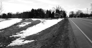
Note the old roadbed framed by the snow in the photo below of the area in early 2011.
Subscribe to:
Post Comments (Atom)


No comments:
Post a Comment